 the mammoth climbs become a thing of the past. Paso La Raya was a long, slow slog, the grade just flat enough to convince our brains we weren´t climbing, but steep enough that our legs knew for sure we were. After what seemed like forever, we finally crested our 10th and final climb over 4000 meters in Peru. The downhill we always anticipate with such long climbs was painfully absent and we were instead faced with an endless ribbon of flatness laid out before us, the 3800+ meter altiplano. Few hills, good wind (sometimes with us, sometimes against us) and steady progress meant we would likely make our goal of Puno before the 2:00 Friday closing of the Bolivian Consulate, our chance to get our visa cheaper and without the hassle typical of South American border crossings. We pushed on clicking off 100+km the first t
 wo days, passing small friendly villages and many local cyclists traveling to and from their fields, pick axes and shovels slung over their shoulders. Often they were cute little old ladies in their wide, thick skirts peddling feverishly on their one speed cruisers, offering friendly well wishes as we casually came up alongside them, us wondering why we needed 27 gears when someone older than my grandmother (no offense Grandma!) only needs one.
 Day 3 was our toughest push and as we searched for our ideal campsite outside the town-on-steroids pueblo of Juliaca, we came up empty. With 135km behind us and a stiff headwind grinding our already aching thighs to the bone, we opted to push the final 10km into town and find a comfy bed for the night. What chaos we rode into. Juliaca turned into one of the most frenzied and frightening city experiences we´ve yet known. Mototaxis, cyclotaxis and all manners of motorized traffic josteled and jived for their spot on the road, leaving the weary cycle tourist lost somewhere in the middle. With no map and dwindling daylight we fought our way to the center of town and after several attempts, finally found an acceptable room for the night.
 We were off at the crack of dawn, determined to beat the traffic and make the final 40km into Puno in time for a fat breakfast. As it turned out, this stretch would prove to be one of the most frightening rides yet in South America. The road was without a shoulder, poorly paved and littered with bus and kombi traffic, all intent on breaking the land speed record for most overloaded vehicle. As they passed us, while passing eachother, we were constantly being pushed off the road, mere inches from the speeding hulks as they exerted their dominance, usually waiting until the split second before they passed us to announce their presence (duh...) with a deafening 10 second blast of their horn.
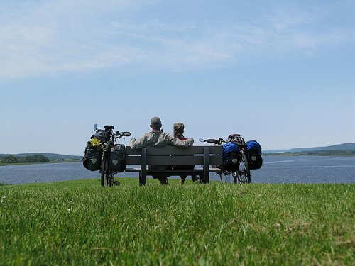
Puno, on the banks of the famed Lake Titicaca, proved to be a much more laidback town. We immediately sought out the Bolivian Consulate, no easy task in a town with no street signs! We found the non discript doorway though and as we stashed our bikes and prepared the small mountain of paperwork required to receive the visa, we were approached by a friendly American woman leaving the consulate who kindly informed us that they had no stickers available and that our mad dash of a ride from Cusco had been for nothing. Go figure. We settled in for a day and a half off and soon hooked up with Japhy, who we hadn´t seen since Huancayo and his friend Natalie. At our hostel the next day, Japhy introduced us to Ted, another cyclist they had met while wandering through town. What a character! Ted is from the Netherlands and is on his third tour through South America. Ted is also 70 and has logged over 300,000km worldwide since his 45th birthday! We were inspired and entertained by the many crazy tales he had to offer from his bike travels throughout the world, our hotel owner seemingly less than entertained as we all laughed hysterically as Ted acted out his adventures on the floor of the hotel lobby.
 been for nothing. Go figure. We settled in for a day and a half off and soon hooked up with Japhy, who we hadn´t seen since Huancayo and his friend Natalie. At our hostel the next day, Japhy introduced us to Ted, another cyclist they had met while wandering through town. What a character! Ted is from the Netherlands and is on his third tour through South America. Ted is also 70 and has logged over 300,000km worldwide since his 45th birthday! We were inspired and entertained by the many crazy tales he had to offer from his bike travels throughout the world, our hotel owner seemingly less than entertained as we all laughed hysterically as Ted acted out his adventures on the floor of the hotel lobby.
We left Puno at the crack of dawn again, facing the same madness of buses and overloaded kombis we enjoyed on the way into town. At least it was flat. As we cycled into the afternoon a car passed with curious license plates...those look familiar, I thought. A few minutes later another...Colorado!! Despite my waves and shouts and obvious enthusiasm, they kept on trucking. Though we missed the chance to chat with our fellow statespeople, we were filled with a momentary twinge of homesickness and an overwhelming longing for a Rio margarita that always comes with thoughts of home these days.
We made the border early the next day. We had opted for the more direct, flatter and decidel
 y sketchier border crossing at Desaquadero. We were quickly stamped out of Peru, but the fun was just beginning. We crossed the bridge into Bolivia and entered immigration, expecting, and finding, the usual fat and shady looking men who held our entrance fate in their chubby little hands. As we began filling out the mountain of paperwork and handing over the equally mountainous stack of $20 US bills (touché, they make Americans jump through the same hoops we make them jump through upon entering the US) I overheard one of the other immigration officials announcing to someone on his phone that 2 Americans on bicycles would be passing through to La Paz. Likely not informing the welcome squad of our arrival, our senses were immediately hightened. After 45 minutes or so of entertaining the fat mans demands, we were finally stamped into Bolivia, no less than 5 times each, and allowed to proceed.
With just the miles to La Paz under our belt, Bolivia looks pretty much the same. The people are slightly more
 reserved, but we have mostly received an abundance of the smiles and waves we grew accustomed to in Peru. A short climb up Paso Lloco Lloco, our first Bolivian 4000 meter crossing, was our only challenge until we reached the outskirts of La Paz, a 20+km maze of sprawl and suburb. La Paz proper is at the bottom of a massive hill, from the top of which you can grasp exactly how big the city is. It is laid out before you in an almost
  incomprehensible mass of brick and concrete that seems to stretch on as far as you can see. As we bumped and ground down the poorly paved road amid a sea of cars screaming passed us, all we could think of was having to climb back out. It was nearly enough to stop us in our tracks. We pushed on though and found ourselves in the middle of absolute madness. With heavy bikes on steep cobblestone streets packed curb to curb with buses, we were fighting for survival, mere minnows in a sea of behmouth whales and man eating sharks. After what seemed like hours, we finally found a place to stay and settled down for some much needed rest.


